OS MasterMap products
The definitive source of detailed geographic data of Great Britain
OS MasterMap products
The definitive source of detailed geographic data of Great Britain
OS MasterMap is the definitive source of highly-detailed geographic data of Great Britain. We offer it in layers (topographic, imagery & networks) and by bespoke area, so you can buy just what you need.
OS MasterMap products
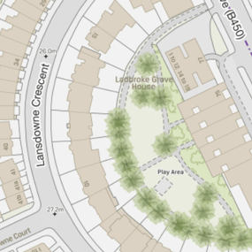
OS MasterMap Topo
The OS MasterMap Topography Layer, more commonly known as OS MasterMap Topo, is the most detailed and accurate view of Great Britain’s landscape – from roads and fields, to buildings, trees, fences, paths and more. In a business of any kind, OS MasterMap Topo will enable you to make assured location-based decisions about your assets, services, environmental risks, customers and operations.
OS MasterMap Sites
OS MasterMap Sites provides a consistent, nationally maintained view of the detailed extents and access points of important locations in Great Britain. The form and function nature of OS MasterMap Sites makes it suitable for risk modelling, business analysis and informed decision-making.
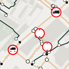
OS MasterMap Highways Network
OS MasterMap Highways Network provides all the highways data you need, in one place. It’s a new, common and authoritative view of the whole road network in Great Britain, ideal for routing and public sector data-sharing.
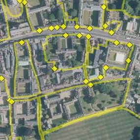
OS MasterMap Imagery
When you need the visual feel for a location, the aerial photography of OS MasterMap Imagery Layer gives you the real-world view with 25cm resolution.
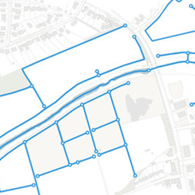
OS MasterMap Water Network
The only detailed, heighted water network of Great Britain showing the flow and precise course of rivers, streams, lakes and canals. It supports flood risk management and is ideal for data sharing.
Deprecated OS MasterMap products

OS MasterMap Integrated Transport Network (ITN)
OS MasterMap Integrated Transport Network (ITN) is a family of products which bring together information from the National Street Gazetteer (NSG), local authorities for England and Wales, and other authoritative sources.
On 31 March 2019, the ITN product was withdrawn and replaced by OS MasterMap Highways Network. Contact us for help with data product migration.
Our added value
A managed OS data supply provides you with expert licensing, a secure delivery platform and the first-class support services needed to optimise value from Ordnance Survey data within your organisation. By working with Europa Technologies, you will automatically receive the following benefits, charged as optional extras by many of our competitors:
- Free consultation – an opportunity to discuss your precise requirements and tailor a bespoke solution.
- Free support – If you have any questions or issues with the product during the licence period, just ask! Our support team is ready to help you.
- Broad range of formats – Ordnance Survey supply their products in limited formats but we can convert into all common GIS and CAD formats such as GeoPackage, MapInfo TAB, Esri Shapefile, Esri File GeoDatabase, Autodesk DWG and others. For many data formats, deliveries can also include our award-winning cartographic styling.
- Expert advice – From an award-winning Ordnance Survey Strategic Partner and Ordnance Survey Accredited Consultant.
If you have a requirement for Ordnance Survey data, or are an existing licence holder and are considering a new supplier, please contact us.
Related products

OS AddressBase products
Identify opportunities, monitor trends, manage risk and deliver better customer service with this essential address-level location intelligence for business and government. OS AddressBase is a tiered product family with coverage of Great Britain and beyond.
Ordnance Survey (OS) map data
OS map data includes a wide range of digital maps and data products from Ordnance Survey – the national mapping agency for Great Britain. It produces and manages data of unparalleled depth, breadth and accuracy, maintaining the definitive record of Britain’s geographic features, relied on by government, business and individuals.
Free data life support
All data products supplied by Europa Technologies include free, world-class, lifetime support.
Got a technical issue or licensing question? No problem – we’re just a call or an e-mail away.
Arrange your digital map licensing through us with the assurance of great value from your data investment.

How can we help you?
Ask an expert…
Do get in touch if you would like more details about OS MasterMap products (technical, licensing, pricing, etc.) or would like to arrange a personalised demo. Our product specialists will be happy to provide you with a free consultation.

