Risks & Perils
Helping you stay informed, prepared and able to respond
Risks & Perils
Helping you stay informed, prepared and able to respond
A portfolio of geo-referenced risks & perils data with models for events including flood, subsidence, political risk and climate change. Serving more than just insurers, these products help you evaluate risk to property and assets, improve readiness and bolster your ability to respond and mitigate.
Risks & Perils
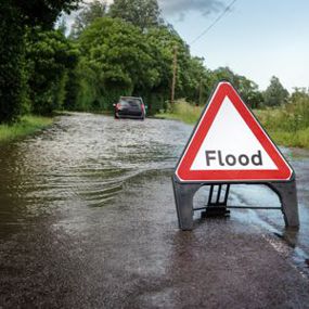
Flood
Flood maps & data are a vital element in land use planning for flood-prone areas. They can identify areas at risk of flooding and help prioritise mitigation measures and response efforts. Flood maps & data enable visualisation and analysis of several flood types, including river, surface water, coastal, groundwater, canal failure and dam break.
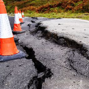
Subsidence
Subsidence and general ground movement data is essential for making confident planning decisions. Produced by expert geologists, these data products cover a range of potential hazards including landslides, shrink-swell clays, soluble rocks, running sands, compressible and collapsible deposits.

UK Radon Potential
Every building contains radon but the levels are usually low. In some parts of the country, however, levels are higher. Where this is the case, it may be necessary to take action. This would include identifying, measuring and mitigating exposure to reduce health risks.
UK Radon Potential shows where higher levels of exposure are likely in the United Kingdom. The data can be used to provide an answer to one of the standard legal search enquiries during house purchase and the level of protection required for extensions and new builds.
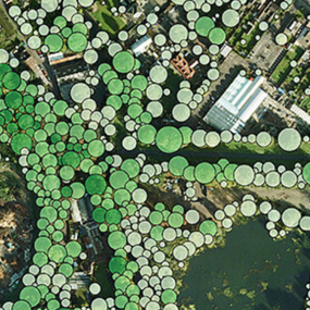
National Tree Map
The National Tree Map™ is the foremost environmental database of its kind. With coverage across Great Britain and Ireland, it contains the location, height and canopy/crown extents for trees 3m and above in height. The National Tree Map can used to meet challenges in a broad range of applications.

Political Risk Intelligence
Political Risk Intelligence provides rich, data-driven information about the dynamics of active and emerging political conflicts worldwide and any resulting security risks for both private and public sector organisations. It can help you identify, measure and visualise the development of political risks over time and affected location.
CRESTA Zones
CRESTA Zones help to analyse and present natural hazard risk, based on the system established by the world’s leading reinsurers. While peril-independent, CRESTA (Catastrophe Risk Evaluating and Standardising Target Accumulations) has established a uniform and global system to transfer, electronically, aggregated exposure data for accumulation risk control and modelling among insurers and reinsurers.
Free data life support
All data products supplied by Europa Technologies include free, world-class, lifetime support.
Got a technical issue or licensing question? No problem – we’re just a call or an e-mail away.
Arrange your digital map licensing through us with the assurance of great value from your data investment.

How can we help you?
Ask an expert…
Do get in touch if you would like more details about Risks and Perils (technical, licensing, pricing, etc.) or would like to arrange a personalised demo. Our product specialists will be happy to provide you with a free consultation.

