Marine Maps, Charts & Data
Supporting nautical environments worldwide
Marine Maps, Charts & Data
Supporting nautical environments worldwide
Gain a better understanding of nautical environments worldwide using charts & vector data sourced from OceanWise and based on data from leading hydrographic offices. When you need intelligent mapping that is fit for purpose, in the right format, accurate and up to date, we have a range of marine products and services to help you.

Marine Themes Vector
Marine Themes Vector is a comprehensive, flexible and intelligent marine mapping product for visualisation and analysis. It is derived from authoritative material obtained from sources including the UKHO and other hydrographic offices. Data attributes have been designed with analysis and querying in mind. Chart boundaries have been removed to create a seamless, simplified data set across charts.
Marine Themes Vector has been engineered for easy data loading with features grouped by theme:
- Elevation
- Shipwrecks and Obstructions
- Industrial Facilities
- Transport
- Administrative and Management Units
- Geographical Regions
Marine Themes Digital Elevation Model (DEM)
Marine Themes Digital Elevation Model (DEM) is a surface model, comprising detailed and accurate data of the seabed. This product utilises the most recent commercial single and multi-beam survey and LIDAR data available. All available surveys are assessed and carefully selected in a deconfliction process. The model can be read directly into GIS and offers many benefits including an attributed coastline, improving the accuracy of the model at the coastal boundary, and the application of an improved interpolation method for a contiguous natural seabed shape.
Marine Themes DEM is available at two resolutions: a 1 arc second model supplied in 0.5 degree tiles and a 6 arc second model supplied in 2 degree tiles. A coverage layer is also provided which provides details of the data sources used in the model, ensuring the source of the data is always clearly defined.

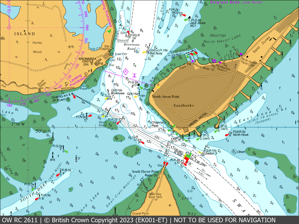
Raster Charts / Raster Charts XL
Raster Charts are electronic versions of the familiar nautical paper charts and are ideal for use as a base map or a simple nautical chart background. Raster Charts are derived from raster-based material obtained under licence from the UKHO and other hydrographic offices. They provide cartographic familiarity for users who work with nautical charts and are ready for immediate use in GIS and other software. While not suitable for navigational use, they are useful as a contextual map for a variety of marine applications such as the monitoring of ports, vessels and platforms.
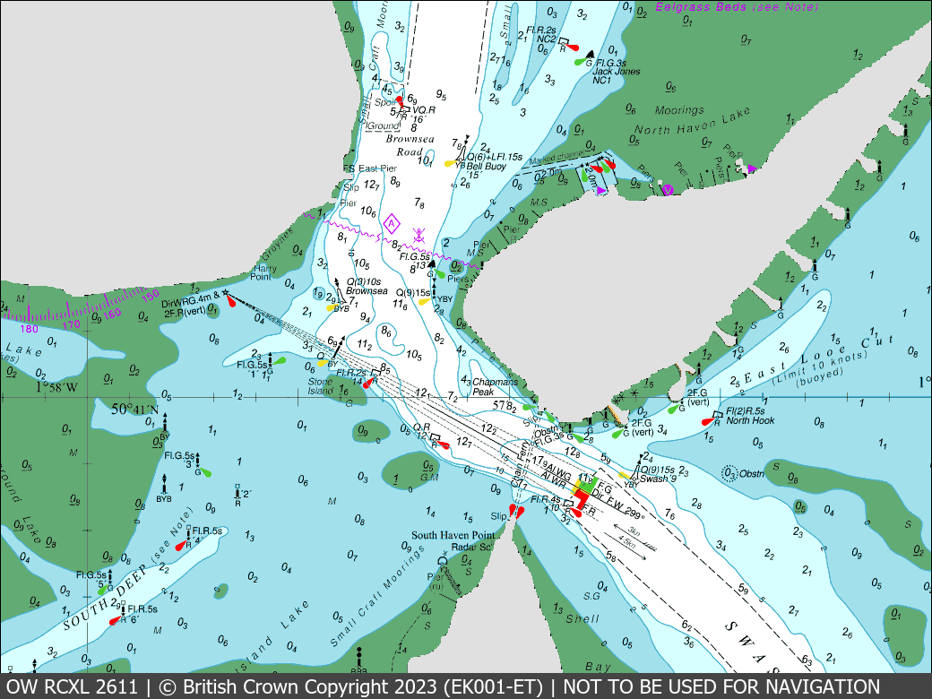
Raster Charts XL (eXcluding Land) are a version of the nautical charts with the land removed, making them ready to be paired with the user’s preferred land mapping.
Our trusted partner
OceanWise is an independent British company which has significant expertise in all aspects of coastal and marine environmental data both at home and internationally. Its raft of experience enables organisations with marine and coastal interests to meet their challenges with comprehensive data acquisition and management.
As a licensed business partner, Europa Technologies can supply and support a wide range of OceanWise products.
Delivery options

viaEuropa
viaEuropa is the award-winning hosted map and API platform from Europa Technologies. It delivers high quality, fully maintained, OceanWise maps directly to your web applications, desktop GIS and mobile apps. Use viaEuropa to drive location intelligent marine solutions quickly, easily and efficiently.
Europa Data Vault
Europa Data Vault is a managed data delivery platform supporting all OceanWise data products, including Marine Themes Vector, Marine Themes DEM, Raster Charts and Raster Charts XL. Data available in a range of spatial data formats and delivered by secure download.
Free data life support
All data products supplied by Europa Technologies include free, world-class, lifetime support.
Got a technical issue or licensing question? No problem – we’re just a call or an e-mail away.
Arrange your digital map licensing through us with the assurance of great value from your data investment.

How can we help you?
Ask an expert…
Do get in touch if you would like more details about Marine Maps, Charts & Data (technical, licensing, pricing, etc.) or would like to arrange a personalised demo. Our product specialists will be happy to provide you with a free consultation.

