OS MasterMap Topo
The most detailed topographic vector mapping of Great Britain
OS MasterMap Topo
The most detailed topographic vector mapping of Great Britain
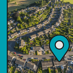
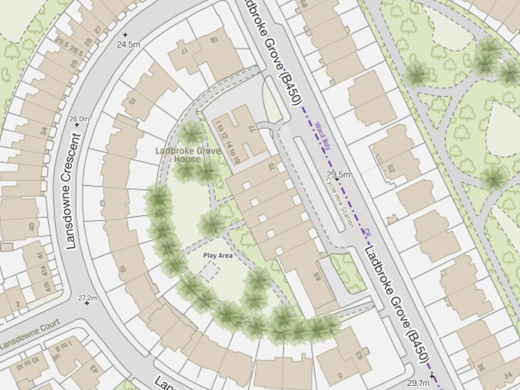
The OS MasterMap Topography Layer, more commonly known as OS MasterMap Topo, is the most detailed and accurate view of Great Britain’s landscape – from roads and fields, to buildings, trees, fences, paths and more. In a business of any kind, OS MasterMap Topo will enable you to make assured location-based decisions about your assets, services, environmental risks, customers and operations.
OS MasterMap Topo
In an organisation of any kind, OS MasterMap Topo gives you the confidence to make location-based decisions about assets, services, environmental risks, customers and operations. The product contains features grouped into themes, such as buildings, land and water, to enable more flexible data selection.
OS MasterMap Topo is the most detailed vector mapping available for Great Britain and is captured and designed for display at 1:1250, 1:2500 and 1:10000 scales in urban, rural and mountain/moorland areas respectively.
The product is updated continuously and released every six weeks.
Topographic identifiers (TOIDs)
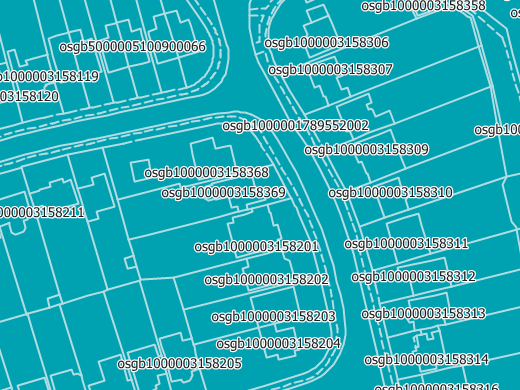
OS MasterMap Topo is ideal for geo-tagging your assets, thanks to the topographic identifier (TOID) at the heart of OS MasterMap products. Each and every feature within OS MasterMap Topo has the TOID as a unique reference. This makes it possible to identify any single feature within the data set without any ambiguity.
TOIDs will stay the same throughout the life cycle of each feature. In other words, if a feature changes, the TOID will stay the same as long as it is deemed to be the same feature; for example, a house having an extension built is still the same house and fulfils the same purpose. This provides a continuity of reference even though a feature may undergo changes.

Reaching new heights in 3D
OS MasterMap Topo now includes a Building Height Attribute, for approximately 43.6 million buildings, chimneys, glasshouses and tanks. This field allows buildings to be extruded into 3D for better analysis of the built environment.
The Building Height Attribute data set is delivered separately from OS MasterMap Topo and updated twice per year, in April and October.
Our added value
A managed OS data supply provides you with expert licensing, a secure delivery platform and the first-class support services needed to optimise value from Ordnance Survey data within your organisation. By working with Europa Technologies, you will automatically receive the following benefits, charged as optional extras by many of our competitors:
- Free consultation – an opportunity to discuss your precise requirements and tailor a bespoke solution.
- Free support – If you have any questions or issues with the product during the licence period, just ask! Our support team is ready to help you.
- Broad range of formats – Ordnance Survey supply their products in limited formats but we can convert into all common GIS and CAD formats such as GeoPackage, MapInfo TAB, Esri Shapefile, Esri File GeoDatabase, Autodesk DWG and others. For many data formats, deliveries can also include our award-winning cartographic styling.
- Expert advice – From an award-winning Ordnance Survey Strategic Partner and Ordnance Survey Accredited Consultant.
If you have a requirement for Ordnance Survey data, or are an existing licence holder and are considering a new supplier, please contact us.
Related products
viaEuropa
viaEuropa is the award-winning hosted map and API platform from Europa Technologies. It delivers high quality, fully maintained, digital maps and geodata directly to your web applications, desktop GIS and mobile apps. Use viaEuropa to drive location intelligent solutions quickly, easily and efficiently.
viaEuropa supports a variety of high-quality content from Ordnance Survey, Ordnance Survey Northern Ireland, Bluesky International, Government of Jersey, JBA Risk Management, British Geological Survey, MB International and OceanWise.
Ordnance Survey (OS) map data
OS map data includes a wide range of digital maps and data products from Ordnance Survey – the national mapping agency for Great Britain. It produces and manages data of unparalleled depth, breadth and accuracy, maintaining the definitive record of Britain’s geographic features, relied on by government, business and individuals.
How can we help you?
Ask an expert…
Do get in touch if you would like more details about OS MasterMap Topo (technical, licensing, pricing, etc.) or would like to arrange a personalised demo. Our product specialists will be happy to provide you with a free consultation.


