OSNI Map Data
High quality mapping from Ordnance Survey Northern Ireland
OSNI Map Data
High quality mapping from Ordnance Survey Northern Ireland
OSNI Map Data is produced by Ordnance Survey of Northern Ireland – the official mapping agency of Northern Ireland. OSNI is part of Land and Property Services (LPS), the government agency that collect, process and manage land and property information. They provide the authoritative digital maps and data for Northern Ireland.
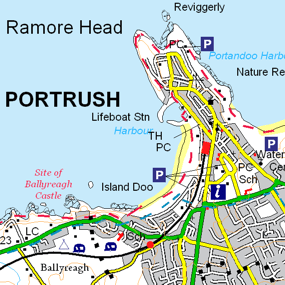
OSNI Map Data – Addressing products
OSNI Pointer
Pointer is the address database for Northern Ireland and the standard address for every property. Land & Property Services (LPS) maintains the database with help from local councils and Royal Mail.
OSNI Map Data – Mapping products

OSNI Fusion
OSNI Fusion is the definitive large scale vector map for Northern Ireland and replaces OSNI Largescale. It consists of a more intuitive structure and contains 13 main themes, with the existing large scale feature types being held as attributes. In a business of any kind, OSNI Fusion gives you the confidence to make location-based decisions about assets, services, environmental risks, customers and operations.

OSNI Aerial Photography
When you need the visual feel for a location in Northern Ireland, OSNI Aerial Photography gives you the real-world view. This impressive imagery product has many applications where a real-world view of the landscape is required, from which accurate measurements can be taken.
OSNI Raster
OSNI Raster products provide a digital equivalent to several popular paper map products. Available in a range of scales, all products include a generous range of features and high quality cartography.
Our added value
By licensing Ordnance Survey Northern Ireland (OSNI) map data products through Europa Technologies, you will automatically receive the following benefits, usually charged additionally by many of our competitors:
- Free Data Life Support – any questions or issues with the product during the licence period, just ask!
- Broad range of formats available – We can deliver data in commonly used formats such as Esri File GeoDatabase, Esri Shapefile, MapInfo TAB and others.
- Expert advice from an award-winning OSNI Licensed Partner.
If you have a requirement for OSNI data, or are an existing licence holder and are considering a new supplier, please contact us.
Related products

viaEuropa
viaEuropa is the award-winning hosted map and API platform from Europa Technologies. It delivers high quality, fully maintained, digital maps and geodata directly to your web applications, desktop GIS and mobile apps. Use viaEuropa to drive location intelligent solutions quickly, easily and efficiently.
viaEuropa supports a variety of high-quality content from Ordnance Survey, Ordnance Survey Northern Ireland, Bluesky International, Government of Jersey, JBA Risk Management, British Geological Survey, MB International and OceanWise.

UK Map Data
We carry only the very best data available for our home nation, including products from trusted sources such as Ordnance Survey, Ordnance Survey Northern Ireland and Bluesky International. Let us help make your UK-based location intelligence solution exceed expectations and deliver eminent success.
Free data life support
All data products supplied by Europa Technologies include free, world-class, lifetime support.
Got a technical issue or licensing question? No problem – we’re just a call or an e-mail away.
Arrange your digital map licensing through us with the assurance of great value from your data investment.

How can we help you?
Ask an expert…
Do get in touch if you would like more details about Ordnance Survey Northern Ireland (OSNI) Map Data (technical, licensing, pricing, etc.) or would like to arrange a personalised demo. Our product specialists will be happy to provide you with a free consultation.

