APGB Services
Fly high with easy access to Aerial Photography Great Britain (APGB) content
APGB Services
Fly high with easy access to Aerial Photography Great Britain (APGB) content
APGB services are available through our award-winning viaEuropa platform. The services include enterprise-grade access to all Aerial Photography Great Britain content, including 12.5cm aerial photography, colour infrared imagery and Digital Terrain Model (DTM) / Digital Surface Model (DSM) layers. viaEuropa provides easy, reliable and improved access to this portfolio of invaluable geospatial products.
APGB – Quick facts
APGB Services
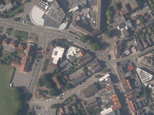
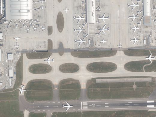
Europa Technologies offers high quality web services supporting the Aerial Photography Great Britain (APGB) contract. Our viaEuropa platform is ideal for providing public sector organisations, who are APGB members, with access to a true colour representation of the real world, with ground features visible at optimal viewing scales down to 1:5k (12.5cm).
APGB services are OGC-compliant and include access via WMTS and WMS. Potential applications include town planning & enforcement, property & facilities management, land use classification & analysis, flood mapping and general cartography.


Full access to APGB content
With complete coverage of Great Britain, viaEuropa supports the full range of content available under APGB:
- Aerial photography (12.5cm)
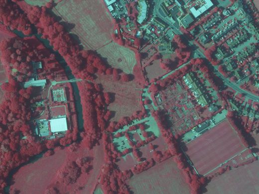
- Colour Infrared Imagery (50cm)
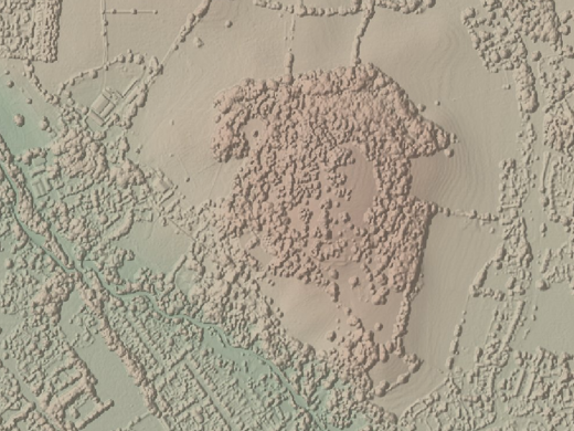
- Digital Terrain Model, DTM (5m)
- Digital Surface Model, DSM (2m)
The hybrid aerial photography layer is available in colour and greyscale versions. The DTM and DSM data is rendered as hill shaded layers in greyscale and with elevation colour (hypsometric) tints.
Lightning fast and super reliable
viaEuropa services are lightning fast and support concurrent requests. This makes the service suitable for real-time applications where response time is critical.
viaEuropa is also super reliable and backed by a Service Level Agreement (SLA) with a 99.9% availability guarantee. Furthermore, rest assured as the actual service availability across all viaEuropa services over the past five years has been an impressive 99.999%.


viaEuropa Trinity
viaEuropa can provide qualifying public sector organisations with access to content from all three of the Geospatial Commission contracts:
- Public Sector Geospatial Agreement (PSGA)
- Aerial Photography Great Britain (APGB)
- Royal Mail Public Sector Agreement (PSL)
Enjoy fast, reliable and convenient access to the exceptional content provided by these contracts – all from one dependable source.
Book a demo today to see how viaEuropa Trinity could help your public sector organisation optimise use of these contracts.
APGB Services

viaEuropa
viaEuropa is the award-winning hosted map and API platform from Europa Technologies. It delivers high quality, fully maintained, digital maps and geodata directly to your web applications, desktop GIS and mobile apps. Use viaEuropa to drive location intelligent solutions quickly, easily and efficiently.
viaEuropa supports a variety of high-quality content from Ordnance Survey, Ordnance Survey Northern Ireland, Bluesky International, Government of Jersey, JBA Risk Management, British Geological Survey, MB International and OceanWise.
Services supporting other public sector contracts

Public Sector Geospatial Agreement (PSGA) Services
Europa Technologies delivers a variety of PSGA services which can help you take advantage of the rich data and new freedoms provided under the Public Sector Geospatial Agreement. With new data products, open identifiers and reduced Ordnance Survey royalties, let us help you maximise the benefits of the PSGA within your public sector organisation.

Royal Mail Public Sector Licence (PSL) Services
We offer a variety of services supporting the Royal Mail Public Sector Licence (PSL) which enable you to make full use of the benefits provided by the Postcode Address File (PAF®). We deliver enriched data products, open identifiers and enterprise-grade API access. Europa Technologies will help your public sector organisation optimise its use of the PSL.
How can we help you?
Ask an expert…
Do get in touch if you would like more details about APGB Services (technical, licensing, pricing, etc.) or would like to arrange a personalised demo. Our product specialists will be happy to provide you with a free consultation.

