PSGA Services
Maximising the benefits of the Public Sector Geospatial Agreement
PSGA Services
Maximising the benefits of the Public Sector Geospatial Agreement
Europa Technologies offers a variety of PSGA services which help you take advantage of the rich data and new freedoms provided under the Public Sector Geospatial Agreement. With new data products, open identifiers and reduced Ordnance Survey royalties, let us help you maximise the benefits of the PSGA within your organisation.
PSGA – Quick Facts
PSGA Services
In April 2020, the UK Government announced a new 10-year agreement with Ordnance Survey. The PSGA is not only a replacement for the Public Sector Mapping Agreement (PSMA) and One Scotland Mapping Agreement (OSMA), but for the first time also provides benefits to non-public sector organisations.
As a leading Ordnance Survey partner, Europa Technologies is ideally positioned to offer PSGA services which encourage innovation and help you discover new opportunities.


API support for new data
viaEuropa provides access to PSGA data products as a high-performance, reliable and secure Application Programming Interface (API). Products supported include OS AddressBase Core/Plus/Premium and OS AddressBase Islands, which provide an essential service for interactive address search and geocoding.
We support the new OS Open Identifiers policy by promoting the use and sharing of Topographic Identifiers (TOID), Unique Property Reference Numbers (UPRN) and Unique Street Reference Numbers (USRN).
Our PSGA services allow software to retrieve data using a well-defined, consistent and programmatic method for performing queries. Organisations of all sizes and industries can use APIs to transform and streamline their business processes.
viaEuropa services are lightning fast and support concurrent requests. This makes the API suitable for real-time applications where response time is critical.
Award-winning map services
viaEuropa delivers beautiful, award-winning maps directly to your web and desktop applications. Supporting a broad range of Ordnance Survey data products, it can provide access to open/premium map data content provided under the PSGA.
The viaEuropa service includes support for a number of Ordnance Survey map products including OS OpenData™, OS VectorMap™ Local and OS MasterMap® Topo. Broad software compatibility is ensured by supporting OGC standards, including WMTS, WFS and WMS.
Critically, viaEuropa services are not throttled or blocked ensuring that PSGA services are not disrupted within an organisation due to a spike in activity. Such spikes are commonplace but difficult to predict, especially from public-facing websites. Finally, unlike some other services, viaEuropa can be deployed for internal business use.

Supporting legacy systems
In a time of budget constraints in the UK public sector, many GIS applications are expected to operate with an extended lifetime. Where those legacy systems are unable to accept OGC-compliant web services bespoke extractions of data in GIS formats must be prepared. This can be a time-consuming challenge to departments with limited resources.
Europa Data Vault ensures that legacy systems never miss a PSGA data update. It is a cost-effective alternative to expensive data translation tools and an arduous DIY approach. In addition to taking the pressure off OS product updates, it also provides access to a useful archive of data deliveries.
PSGA Services

viaEuropa
viaEuropa is the award-winning hosted map and API platform from Europa Technologies. It delivers high quality, fully maintained, digital maps and geodata directly to your web applications, desktop GIS and mobile apps. Use viaEuropa to drive location intelligent solutions quickly, easily and efficiently.
viaEuropa supports a variety of high-quality content from Ordnance Survey, Ordnance Survey Northern Ireland, Bluesky International, Government of Jersey, JBA Risk Management, British Geological Survey, MB International and OceanWise.

Europa Data Vault
Europa Data Vault is a managed data delivery platform supporting OS data products, including OS MasterMap, VectorMap Local and AddressBase. The service delivers the latest version of all key products included in the Public Sector Geospatial Agreement (PSGA). Data is available in a range of spatial data formats and delivered by secure download.
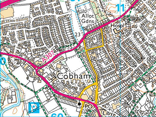
Ordnance Survey (OS) map data
OS map data includes a wide range of digital maps and data products from Ordnance Survey – the national mapping agency for Great Britain. It produces and manages data of unparalleled depth, breadth and accuracy, maintaining the definitive record of Britain’s geographic features, relied on by government, business and individuals.
Services supporting other public sector contracts

Aerial Photography Great Britain (APGB) Services
APGB services are available through our award-winning viaEuropa platform. The services include enterprise-grade access to all Aerial Photography Great Britain content, including 12.5cm aerial photography, colour infrared imagery and Digital Terrain Model (DTM) / Digital Surface Model (DSM) layers. viaEuropa provides easy, reliable and improved access to this portfolio of key geospatial products.

Royal Mail Public Sector Licence (PSL) Services
We offer a variety of services supporting the Royal Mail Public Sector Licence (PSL) which enable you to make full use of the benefits provided by the Postcode Address File (PAF®). We deliver enriched data products, open identifiers and enterprise-grade API access. Europa Technologies will help your public sector organisation optimise its use of the PSL.
How can we help you?
Ask an expert…
Do get in touch if you would like more details about PSGA Services (technical, licensing, pricing, etc.) or would like to arrange a personalised demo. Our product specialists will be happy to provide you with a free consultation.

