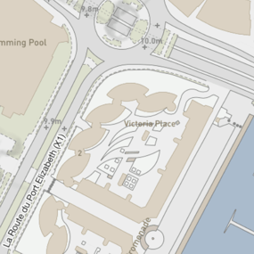
Government of Jersey Map Data
High quality map data products from authoritative source
Government of Jersey Map Data
High quality map data products from authoritative source
Europa Technologies can supply authoritative Government of Jersey map data. As an appointed business partner, we can provide high-quality addressing, vector data and aerial photography content which have unparalleled depth, breadth and accuracy. As the definitive record of Jersey’s geographic features, this data is relied upon by government, businesses and individuals alike.
Government of Jersey Map Data
Jersey Address Database
The Jersey Address Database is derived from the Jersey Land & Property Index (JLPI) which is the definitive source of address data for the Bailiwick of Jersey. The gazetteer contains over 65,000 records, including unique property reference numbers (UPRN), for addresses of properties, businesses, field numbers and places of interest.
Jersey Vector Basemap
Jersey Vector Basemap consists of GIS/CAD-ready layers of detailed geographic information. Sourced from the Government of Jersey, this comprehensive product is the most detailed topographic mapping of the island. With this rich data asset, you can have confidence in making location-based decisions about resources, services, environmental risks, customers and operations across Jersey.
Our added value
By licensing Government of Jersey map data products through Europa Technologies, you will automatically receive the following benefits:
- Free consultation – an opportunity to discuss your precise requirements and tailor a bespoke solution.
- Free support – If you have any questions or issues with the product during the licence period, just ask! Our support team is ready to help you solve problems and make the most from your data investment.
- Broad range of formats – We support all common GIS and CAD formats such as GeoPackage, MapInfo TAB, Esri Shapefile, Esri File GeoDatabase, Autodesk DWG and others. For many formats, deliveries can also include our award-winning cartographic styling.
- Expert advice – From a Government of Jersey appointed business partner.
If you have a requirement for authoritative Government of Jersey map data, please contact us.

Related products
UK Map Data
We carry only the very best data available for our home nation, including products from trusted sources such as Ordnance Survey, Ordnance Survey Northern Ireland and Bluesky International. Let us help make your UK-based location intelligence solution exceed expectations and deliver eminent success.
Free data life support
All data products supplied by Europa Technologies include free, world-class, lifetime support.
Got a technical issue or licensing question? No problem – we’re just a call or an e-mail away.
Arrange your digital map licensing through us with the assurance of great value from your data investment.
How can we help you?
Ask an expert…
Do get in touch if you would like more details about Government of Jersey Map Data (technical, licensing, pricing, etc.) or would like to arrange a personalised demo. Our product specialists will be happy to provide you with a free consultation.


