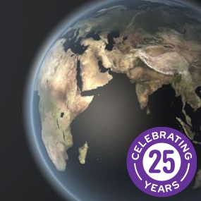
Global Insight
The leading world map & global gazetteer
Global Insight
The leading world map & global gazetteer
Global Insight can underpin location intelligence solutions requiring global search and geocoding capabilities plus essential base mapping. It is ideal for highlighting the location of a place against a simple but accurate political map of the world.
Global Insight
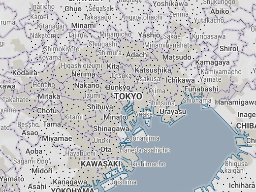
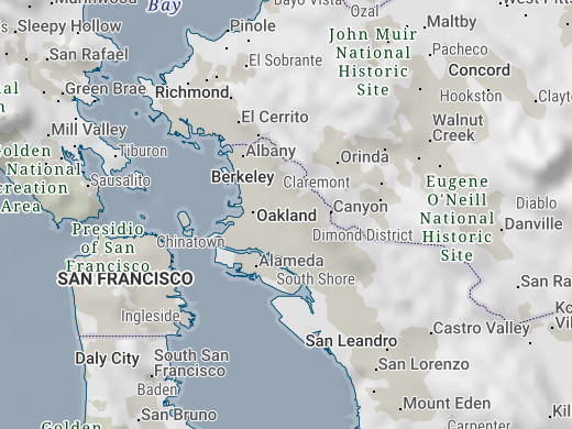
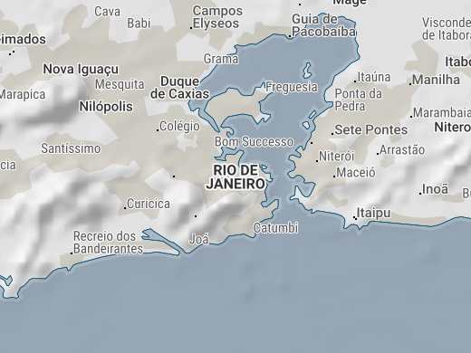
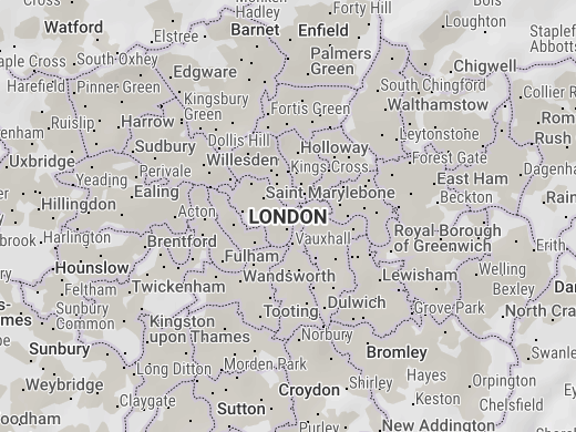
Global Insight offers 1:1,000,000 scale digital mapping for the entire world. With coverage divided by feature over a number of intermatching layers, it is an ideal data set for global location mapping.
The product provides up-to-date political entities, coastlines, international borders, first level administrative borders, some second level administrative borders, time zones (with DST/daylight saving periods for this/next year), points of interest and over 2 million place names with urban sprawls.
Comprehensive places gazetteer
Global Insight contains more than 1.6 million places with over 2 million names.
In addition to local names, alternative forms are provided. These include English conventional name (e.g. Roma / Rome), foreign exonyms (including French, German, Italian, Spanish, Dutch, Portuguese, Danish, Swedish, Norwegian, Finnish, Japanese [Kanji & Katakana], Arabic, Russian, simplified Chinese, Hebrew, Korean, Thai, Vietnamese, Greek & Turkish), second national language (e.g. Finnish: Helsinki / Swedish: Helsingfors), legacy names (e.g. Peking / Beijing) or long/short form (e.g. Kingston / Kingston-upon-Thames).
The comprehensive places gazetteer of Global Insight can provide a superior match rate for your global searches and geocoding.


As featured in Google Earth
and Google Maps
The international/national boundaries and place names of Global Insight can be found within the ubiquitous Google Earth and Google Maps services. Through this long-standing integration, Global Insight has been seen by over one billion people, approximately one in seven of the world’s entire population.
New in Global Insight 2024.2
Version 2024.2 was released in June 2024 and includes:
- Addition of Esri ArcGIS Pro project files
- Addition of over 37,000 population estimates
- Updated time zones with DST for 2024/2025
- Expo: Updated earthquakes database
- General maintenance and improvements

Rich map layers
Global Insight consists of the following intermatching map data layers. Additionally, the product contains Expo – a curated set of guest content from trusted partners and carefully selected third parties.
Standard Content
- Political Land Masses
- Coastlines
- Political Reference
- International Borders
- 1st Level Administrative Reference
- 1st Level Administrative Borders
- 2nd Level Administrative Borders
- Places (1.6m+ with 2m+ names)
- Points of Interest (POI)
- Urban Sprawls
- Time Zones with DST
- Deserts
- Sea Bathymetry
- Ocean Features
- Simple Grids
- Military Grid (MGRS)
- Superfund Grids
- Uber H3 Grids
- UTM Zones
- MARPOL 73/78, PSSA
- Antarctica claims
- Chinese nine-dash line
- Flag Images
Expo Content
- Shaded Relief
- Exclusive Economic Zones
- Earthquakes
- Tectonic Plates
- NASA Blue Marble
- NASA Black Marble
- Monthly Cloud Cover (2023)
- Earth Gravitational Model (EGM2008) grid/raster
- Climate Change – Global Temperatures
- Köppen−Geiger Climate Classification
- UNESCO World Heritage List
Looking for a global map data product with roads, railways, drainage (rivers & lakes), airport and ports? Check out Global Insight Plus
A myriad of applications
There are an unlimited number of uses for Global Insight. Potential applications include:
- General reference mapping
- Global geocoding by place name
- International strategic planning
- Travel planning & transportation tracking
- Telecommunications
- Mining, oil & gas exploration
- Place name overlay for satellite imagery


Data formats & delivery
Global Insight is available in many popular GIS formats, including:
- Esri Shapefile
- Esri File GeoDatabase
- MapInfo TAB (Extended)
All data products are delivered using our secure data delivery platform, Europa Data Vault.
Flexible licensing
Global Insight can be licensed for a single user, multiple users, server or corporate use. The product is provided subject to our standard End User Licence Agreement (EULA) for global data products. Additionally, attractive licensing terms are available to organisations who wish to integrate Global Insight into their own software products and services.
Please contact us to discuss your specific requirements and request pricing information.

Related products
Global Map Data
Global map data is a cornerstone in the history of Europa Technologies. Our market-leading data products are the choice of SMEs, prestigious Fortune Global 500 companies, governments and missions of the United Nations. As a result of a long-standing integration with Google Earth and Google Maps, our global data products have been seen by over one billion people, approximately one in seven of the world’s entire population.
Free data life support
All data products supplied by Europa Technologies include free, world-class, lifetime support.
Got a technical issue or licensing question? No problem – we’re just a call or an e-mail away.
Arrange your digital map licensing through us with the assurance of great value from your data investment.

How can we help you?
Ask an expert…
Do get in touch if you would like more details about Global Insight (technical, licensing, pricing, etc.) or would like to arrange a personalised demo. Our product specialists will be happy to provide you with a free consultation.

