Map data for
Canada

Map data for
Canada

Europa Technologies supplies a wide variety of map data products for Canada and nearly every other country of the world. From Afghanistan to Zimbabwe, we are your trusted advisor on map data products which form the lifeblood of location intelligence solutions.

Flag of CanadaCanada – Quick facts

0
Area (sq km)
0m
Population
0bn
GDP (PPP) 2018
#0
GDP (PPP) Rank
Situated in the northern part of North America, Canada is the second largest country by land mass, but with a relatively low population. Around 80%of the population lives within 300 km of Canada’s southern border with USA. The country is made up of ten provinces and three territories. Ottawa is the capital city.
A commonwealth nation, Canada is a federal parliamentary democracy, with a constitutional monarchy. Because of high immigration, Canada is regarded as one of the most ethnically diverse nations. The long and complex relationship with USA has had an impact on Canadian culture and economy.
Canada is a highly developed nation, with a strong economy, and relies heavily on abundant natural resources and trade networks. Tourism is an important part of the economy.
It is a member of several international institutions including the United Nations, G7 and NATO.
Postcodes / Zipcodes

Postcodes / Zipcodes

Postcode / Zipcode data is available for Canada.

Postcodes are an important tool for geographic planning in Canada. Centroids are suitable for coarse searching and geocoding while regions can be effectively used for visualisation purposes.

Postcodes / Zipcodes
Regions & Boundaries

Regions & Boundaries

Regions & boundaries data is available for Canada.

Regions and Boundaries map data helps you display and analyse key factors geographically. They can easily be matched and enriched with your own data or supplemented with statistics such as demographics, purchasing power and consumer profiles.

Regions & Boundaries
Ddemographics

Demographics

Demographic data is available for Canada.

Demographic data presents the number of households, population figures by sex and age band plus the number of unemployed.

Demographics
Purchasing Power

Purchasing Power

Purchasing power data is available for Canada.

Purchasing Power describes the disposable income (before deductions) of populated areas. It is a key indicator for sound location and sales territory planning.

Purchasing Power
Consumer Profiles

Consumer Profiles

Consumer Profile data is available for Canada.

Consumer Profiles uses an innovative segmentation model for effective market investigation and identification of your target audience.

Consumer Profiles
HERE Maps

HERE Maps

HERE Maps are available for Canada.

HERE Maps has been at the forefront of mapping innovations for decades, serving automotive OEMs, businesses and governments that require the most accurate location intelligence.

HERE Maps
Flood Maps

Flood Maps

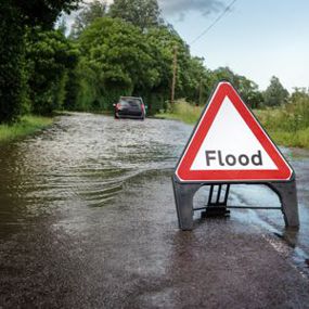
Flood maps are available for Canada.

Flood map data provide extents and depths for multiple return periods, covering both river and surface water flooding, as well as coastal flooding in some countries.

Flood Maps
CRESTA Zones

CRESTA Zones

CRESTA Zones are available for Canada.

CRESTA Zones help to analyse and present natural hazard risk, based on CRESTA zones, using the system established by the world's leading reinsurers. While peril-independent, CRESTA (Catastrophe Risk Evaluating and Standardising Target Accumulations) has established a uniform and global system to transfer, electronically, aggregated exposure data for accumulation risk control and modelling among insurers and reinsurers.

CRESTA Zones
Market Trace

Market Trace

Market Trace data services are available for Canada.

Market Trace is a new data service providing unique insight into patterns of visitor behaviour. This innovative service uses anonymised location data from mobile applications, professionally analysed and customised to your specific needs. It can distinguish between locals and visitors, segment by time and profile visit duration.

Market Trace
Marine Maps

Marine Maps

Marine Maps are available for Canada.

Intelligent marine and coastal map data drives planning, engineering, asset management, operations, regulation and a multitude of other applications.

Marine Maps
Global Map Data

Global Maps

For geographic coverage of Canada and beyond, we offer a premier global map data suite. Global mapping is a cornerstone in the history of Europa Technologies. Our market-leading data products are the choice of SMEs, prestigious Fortune Global 500 companies, governments and missions of the United Nations. As a result of a long-standing integration with Google Earth and Google Maps, our global data products have been seen by over one billion people, approximately one in seven of the world's entire population.

Europa Technologies - mapping the world for 25 years, 1997 - 2022.

Global Map Data

Free data life support

All data products supplied by Europa Technologies include free, world-class, lifetime support.

Got a technical issue or licensing question? No problem – we’re just a call or an e-mail away.

Arrange your digital map licensing through us with the assurance of great value from your data investment.

Data Life Support

How can we help you?

Ask an expert…

Do get in touch if you would like more details about Map Data for Canada (technical, licensing, pricing, etc.) or would like to arrange a personalised demo. Our product specialists will be happy to provide you with a free consultation.