OS Terrain 5
A true virtual landscape of Great Britain
OS Terrain 5
A true virtual landscape of Great Britain
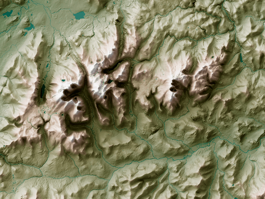
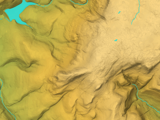
OS Terrain 5 is a fully maintained, analytical height product, modelling the shape of Great Britain’s landscape. This detailed digital terrain model (DTM) of Great Britain is available as a grid of heighted points and contours, both at five-metre intervals.
OS Terrain 5
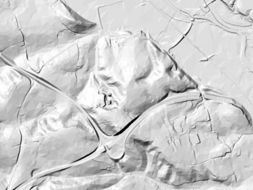
OS Terrain 5 is ideal for 3D visualisations. It models significant landscape features including roads, railways, slopes, quarries and lakes, and offers a typical accuracy level greater than 2m RMSE (Root Mean Square Error).
OS Terrain 5 adds the third dimension to OS MasterMap Topography Layer. You won’t find another height product for Great Britain with this level of consistency, currency and detail.
OS Terrain 5 is updated quarterly, with releases in January, April, July and October.
Understand flood
OS Terrain 5 has the horizontal and vertical accuracy to model flood events. You can quickly understand the impact of flash floods on roads, homes and other major infrastructure. You’re able to assess the lie of the land on-screen, reducing the need for time-consuming site visits.
In order to respond to the Flood and Water Management Act 2010, the extent of all flat water bodies greater than 0.7 hectares in area (greater than 7 000 cubic metres capacity) will have their limits captured to ensure that the presence of the water body can be inferred from the data.


Harness the elements
OS Terrain 5 is the height data you need to model construction projects within the wider landscape. This helps you give planners an accurate virtual view of your plans and the steps you’re taking to minimise their visual impact on the surrounding area.
OS Terrain 5 helps you analyse wind speed and signal propagation. This is important when siting wind turbines, best located in exposed upland areas to maximise their power output, and mobile phone masts, which serve ever more data-hungry users.
Our added value
A managed OS data supply provides you with expert licensing, a secure delivery platform and the first-class support services needed to optimise value from Ordnance Survey data within your organisation. By working with Europa Technologies, you will automatically receive the following benefits, charged as optional extras by many of our competitors:
- Free consultation – an opportunity to discuss your precise requirements and tailor a bespoke solution.
- Free support – If you have any questions or issues with the product during the licence period, just ask! Our support team is ready to help you.
- Broad range of formats – Ordnance Survey supply their products in limited formats but we can convert into all common GIS and CAD formats such as GeoPackage, MapInfo TAB, Esri Shapefile, Esri File GeoDatabase, Autodesk DWG and others. For many data formats, deliveries can also include our award-winning cartographic styling.
- Expert advice – From an award-winning Ordnance Survey Strategic Partner and Ordnance Survey Accredited Consultant.
If you have a requirement for Ordnance Survey data, or are an existing licence holder and are considering a new supplier, please contact us.
Related products
Ordnance Survey (OS) map data
OS map data includes a wide range of digital maps and data products from Ordnance Survey – the national mapping agency for Great Britain. It produces and manages data of unparalleled depth, breadth and accuracy, maintaining the definitive record of Britain’s geographic features, relied on by government, business and individuals.
Documentation & Resources
As part of our support for Terrain 5, we provide a full, up-to-date library of documentation and resources, including product guides and technical specifications.

How can we help you?
Ask an expert…
Do get in touch if you would like more details about OS Terrain 5 (technical, licensing, pricing, etc.) or would like to arrange a personalised demo. Our product specialists will be happy to provide you with a free consultation.

