Construction Services
High quality location data for Great Britain
Construction Services
High quality location data for Great Britain
OS Points of Interest » Commercial Services » Construction Services
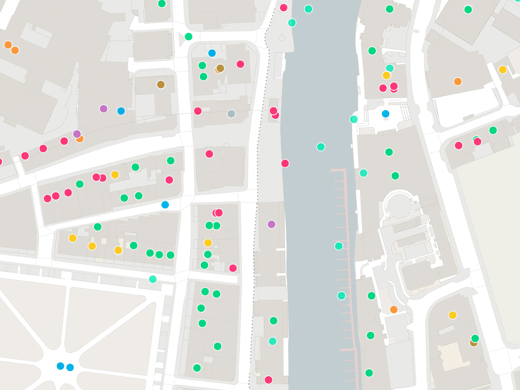
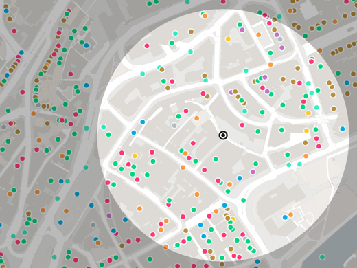
OS Points of Interest contains over 3.6 million geographic features, supplied with location, functional information and addresses where possible. The Construction Services category is available for the whole of Great Britain or specific areas of your choice.

Construction Services – location data for Great Britain
This data comes from OS Points of Interest which contains well over three million records. The Construction Services category contains 123,709 locations for Great Britain, but this can be filtered by class and geography. Europa Technologies offers you a fully bespoke service, allowing you to order just what you need and maximise the value of your data investment.
Analyse beyond address
OS Points of Interest includes locations in a Construction Services category which can be identified by their use and function as well as by their postal address or geography. Each record also contains a telephone number, website address and brand, where appropriate.
For the public sector, OS Points of Interest lets you identify gaps in services and analyse changes in city centre retail space over time. This helps you maintain a quality environment for your residents, shoppers and visitors.


Multi-tier hierarchy
OS Points of Interest is organised into a 3-tier hierarchy with 9 groups, 88 categories and 599 classes. Construction Services is a category which can be sub-divided into 19 classes:
- Building and Component Suppliers
- Building Contractors
- Construction Completion Services
- Construction Plant
- Cutting, Drilling and Welding Services
- Demolition Services
- Diving Services
- Electrical Contractors
- Fencing and Drystone Walling Services
- Gardening, Landscaping and Tree Surgery Services
- Glaziers
- Metalworkers including Blacksmiths
- Painting and Decorating Services
- Plasterers
- Plumbing and Heating Services
- Pool and Court Construction
- Restoration and Preservation Services
- Road Construction Services
- Roofing and Chimney Services
Click on a class name to explore the location data available.
Our added value
A managed OS data supply provides you with expert licensing, a secure delivery platform and the first-class support services needed to optimise value from Ordnance Survey data within your organisation. By working with Europa Technologies, you will automatically receive the following benefits, charged as optional extras by many of our competitors:
- Free consultation – an opportunity to discuss your precise requirements and tailor a bespoke solution.
- Free support – If you have any questions or issues with the product during the licence period, just ask! Our support team is ready to help you.
- Broad range of formats – Ordnance Survey supply their products in limited formats but we can convert into all common GIS and CAD formats such as GeoPackage, MapInfo TAB, Esri Shapefile, Esri File GeoDatabase, Autodesk DWG and others. For many data formats, deliveries can also include our award-winning cartographic styling.
- Expert advice – From an award-winning Ordnance Survey Strategic Partner and Ordnance Survey Accredited Consultant.
If you have a requirement for Ordnance Survey data, or are an existing licence holder and are considering a new supplier, please contact us.
Related products

OS Points of Interest
Points of Interest contains well over three million records, sourced and quality-checked from more than 100 leading listing suppliers. You can tailor your order to just what you need and the tiered classifications make it easy to target your selection.

AddressHub
AddressHub is an address product for Great Britain built upon definitive Royal Mail Postcode Address File (PAF®) data, enhanced with UPRN (Unique Property Reference Number), coordinates and other valuable attributes. Designed to deliver a cost-effective addressing capability to organisations of any size, AddressHub opens the door to connect databases from multiple sources. Search, locate and identify addresses with ease and precision.

OS AddressBase Core
As the entry-level addressing product from Ordnance Survey, AddressBase Core gives easy access to complete and accurate address data for 33 million properties in Great Britain, including unique property reference numbers (UPRN) and additional attributes. Use this easy-to-use product to identify a property and locate it on a map with precision. AddressBase Core is available to Public Sector Geospatial Agreement (PSGA) members and to business customers under commercial licensing.

OS Code-Point products
OS Code-Point products precisely locate 1.7 million postcode units in Great Britain and Northern Ireland, either as points or polygons. Ideal for direct marketers, Code-Point Products help you maximise your response rates by targeting customers in the best postcodes for your offering.
Documentation & Resources
As part of our support for OS Points of Interest, we provide a full, up-to-date library of documentation and resources, including product guides and technical specifications.

How can we help you?
Ask an expert…
Do get in touch if you would like more details about OS POI data - Construction Services (technical, licensing, pricing, etc.) or would like to arrange a personalised demo. Our product specialists will be happy to provide you with a free consultation.

