CRESTA Zones Map Data
for Finland
CRESTA Zones Map Data
for Finland
CRESTA zones map data for Finland helps to analyse and present natural hazard risk, based on the system established by the world’s leading reinsurers. While peril-independent, CRESTA (Catastrophe Risk Evaluating and Standardising Target Accumulations) has established a uniform and global system to transfer, electronically, aggregated exposure data for accumulation risk control and modelling among insurers and reinsurers.

CRESTA zones map data
for Finland
CRESTA zones were originally developed as a joint project of the Swiss Reinsurance Company, the Gerling-Konzern Globale Reinsurance Company and the Munich Reinsurance Company. Europa Technologies was part of the original team who brought the standard into the digital mapping era and has maintained a CRESTA zone map data product longer than any other vendor.
Insurance professionals need accurate and reliable maps and databases. In today’s times of climate change, demand has increased for location intelligence to manage risks and reduce exposure. Our CRESTA zones map data for Finland offers insurers an important basis for aggregated risk assessment, exposure management and reinsurance negotiation & reporting.
 Finland – Quick facts
 Finland – Quick facts
Global CRESTA Plus
Global CRESTA Plus is our digital implementation of the CRESTA standard. Given a location in Finland, the product enables applications to look up the applicable CRESTA zone and then analyse/present aggregate risk across a portfolio. Applications can be further enhanced by adding a variety of natural hazard data sets such as earthquake locations, storm paths, meteorological, geological and insurance-specific statistical data.
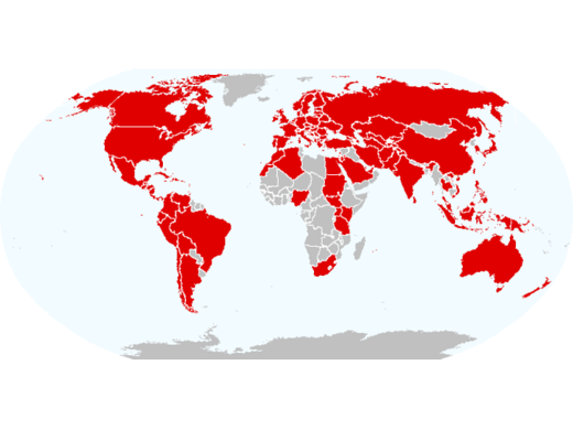
Global CRESTA Plus can be licensed just for Finland, by continent or world-wide.
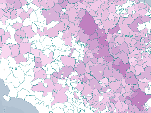
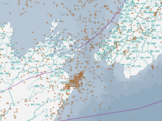

High & low resolutions zones
In accordance with the published standard, Global CRESTA Plus is available in high and low resolution versions. Please note that both products are at the same scale and accuracy, but the high resolution version contains more granular zones which are generally required for catastrophe modelling applications using CRESTA zones.
| CRESTA Zones Map Data for Finland | |
|---|---|
| Low Resolution | High Resolution |
Available through viaEuropa
CRESTA Zones for Finland is available through viaEuropa – the award-winning hosted map and API platform from Europa Technologies.
viaEuropa delivers high quality, fully maintained, digital maps and location data directly to your web applications, desktop GIS and mobile apps. Use viaEuropa to drive location intelligent solutions quickly, easily and efficiently.
Utilise the viaEuropa API service to look-up the high/low resolution CRESTA zone ID for any location in Finland, or use the WMTS/WMS service to visualise your locations on a CRESTA zone map.

Data formats & delivery
CRESTA zones map data for Finland is available in the following popular GIS formats:
- Esri Shapefile
- Esri File GeoDatabase
- MapInfo TAB (Extended)
All data products are delivered using our secure data delivery platform, Europa Data Vault.

Related products
Global CRESTA Plus
Global CRESTA Plus helps brokers and reinsurers assess and present natural hazard risk, based on CRESTA zones, using the system established by the world’s leading reinsurers. It enables applications to quickly establish the CRESTA zone and then analyse/present aggregate risk across a portfolio. Global CRESTA Plus offers insurers an important basis for aggregated risk assessment, exposure management and reinsurance negotiation and reporting.

Risk Insight
Risk Insight offers a powerful yet intuitive means of assessing risk intelligence across your property portfolio. Developed for insurers, public sector bodies and property managers, it provides a clear picture and understanding of individual risks and overall exposure. Implemented as an online service, Risk Insight can be integrated with your internal systems to provide a rich, seamless experience for your users.
Free data life support
All data products supplied by Europa Technologies include free, world-class, lifetime support.
Got a technical issue or licensing question? No problem – we’re just a call or an e-mail away.
Arrange your digital map licensing through us with the assurance of great value from your data investment.

How can we help you?
Ask an expert…
Do get in touch if you would like more details about CRESTA Zones for Finland (technical, licensing, pricing, etc.) or would like to arrange a personalised demo. Our product specialists will be happy to provide you with a free consultation.

