Case Study – Welsh Government
Using viaEuropa to underpin public facing web mapping applications
Case Study – Welsh Government
Using viaEuropa to underpin public facing web mapping applications
Key Facts
- Deployed within 3 days
- Implemented in a few lines of code
- Reusable base map resource
- Consistent and detailed base maps
- Supports PSGA (formerly PSMA) data assets
- Includes OS VectorMap Local
- Fully managed service
- Maintenance-free updates

Overview
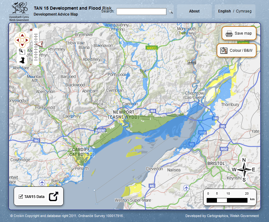
The Welsh Government is using the viaEuropa for PSGA hosted map service from Europa Technologies to underpin its public facing web mapping applications. The service provides access to Ordnance Survey digital map data (including OS VectorMap Local® and OS OpenData™) as a service. The service was first deployed in the Development and Flood Risk Advice Map, providing citizens with self-service access to information on flood risk zones across Wales. Previously, such information was only available by submitting a written request for a given address and was provided in paper form only.
What was the outcome?
In response to a tight ministerial delivery schedule, the website went live within three days of the Welsh Government subscribing to the viaEuropa service. The service provides a reusable resource of consistent, detailed and intuitive base maps that the Welsh Government hopes to make further use of in the future. Additional applications already launched include the Marine conservation zone map viewer (to encourage citizen engagement in the consultation process), the Wales Noise Mapping application (publishing estimated noise levels in the three largest urban areas in Wales) and My Local School (a website designed to open up access to schools data for parents and all others with an interest in their local school).

About Europa Technologies
Europa Technologies offers a range of products and services for the Public Sector. In addition to the provision and hosting of Ordnance Survey data, third party data sets including points of interest, risk and demographic data can also besupplied and served through the viaEuropa hosted map service. Europa Technologies is an award-winning specialist in digital maps and associated services for a wide variety of market sectors and applications. Our resources allow organisations with international interests to better understand their customers, assets and markets, in a geographic context, to gain a competitive or strategic advantage. Mapping products and services from Europa Technologies are used by many Fortune Global 500 companies, governments and missions of the United Nations. The company has global licence agreements with a number of leading Internet-based service providers including Google. Through deployment via Google Earth and Google Maps alone, our world data products have been seen by over one billion people, approximately 1 in 7 of the world’s entire population. For further information on our products and services for the Public Sector, including an obligation-free trial of the viaEuropa hosted map service, please contact us today.
How can we help you?
If you have any questions about this case study, please contact a member of our team who will be happy to help you.


