Regions & Boundaries
map data for Peru

Regions & Boundaries
map data for Peru

Regions and Boundaries map data for Peru helps you display and analyse key factors geographically. They can easily be matched and enriched with your own data or supplemented with statistics such as demographics, purchasing power and consumer profiles.
Regions & Boundaries

Regions & Boundaries map data for Peru

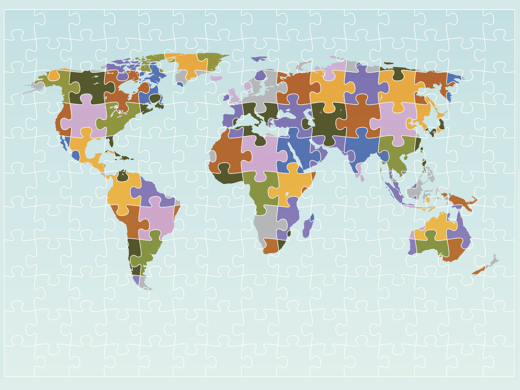
Regions & Boundaries map data provides a geographic breakdown of Peru for visualisation and analysis purposes. Using GIS or mapping software, colours can be assigned to these regions to form a thematic map, also known as a choropleth map. Thematic maps are visually powerful and a simple but effective way to communicate a variable (e.g. sales figures) across a geographic area. Regions can be political/administrative, postcode or small areas often connected with a census. With seamless transitions across borders with neighbouring countries, this data product is ideal for international projects.

Further enabling geographic analysis, Regions & Boundaries for Peru can also be supplemented with statistics such as socio-demographics, purchasing power and consumer profiles. This product is available in a number of popular GIS data formats.

Book a Demo

Flag of PeruPeru – Distritos

1874
Number of Regions
17000
Avg Population / Region
Situated in western South America, the Republic of Peru is bordered by Ecuador, Colombia, Brazil, Bolivia and Chile. Its coastline is along the Pacific Ocean. The capital city is Lima.
Home to several ancient cultures, Peru has one of the longest histories of civilisation of any country in the world, including the Note Chico, the oldest civilisation in South America and the Inca Empire. Conquered by the Spanish in 1500s, it became known as the Viceroyalty of Peru. Silver and gold were mined extensively and the native populations wiped out by disease. In Lima, the Spanish established South America’s first university in 1551, The National University of San Marcos. Independence from Spain was declared in 1821, and three years later, after the battle of Ayacucho, independence was complete. Some economic stability ensued from the exploitation of guano, but political stability was erratic. Marred by war with Chile, unrest, coups and internal conflict dominated the politics and economy of twentieth century Peru. By 2000, Peru’s economy flourished with a boom in commodities. The country is now a representative democratic republic, divided into twenty-six units.
Peru’s economy is led by the service industry, particularly tourism. Manufacturing and agriculture are significant, and growing sectors include telecommunications and bio-technology. Exports include gold, copper, zinc and textiles. It is one of the fastest-growing economies in South America and has attracted a good deal of foreign investment. It has also become the world’s leading producer of cocaine.
Rapid economic growth has resulted in rapid urbanisation, and three quarters of the population live in or around cities. Peruvians are ethnically very diverse with Mestizos (mixed race), Amerindian, European, African and Asian heritage. Spanish is the main language but a number of indigenous languages are recognised.
With such rich heritage, including cities from the Incan Empire, Peru has a wealth of cultural tradition. Art, including pottery, painting and jewellery, as well as music, are deeply rooted in ancient tradition, but with strong European influence. Traditional Peruvian food contains potato, and there are over 3,000 varieties grown in Peru. Overall, cuisine is very diverse, with multiple influences from migrant populations.
Peru is a member of the United Nations, the Organisation of American States and the Pacific Alliance.

Product details

Regions & Boundaries map data for Peru
Administrative Postcode Small Area
Available
Region Type Distritos
Number of Regions 1,874
Average Population/Region 17,000

Looking beyond Peru? Regions & Boundaries map data is available for a wide range of countries…

Data formats & delivery

Regions & Boundaries map data for Peru is available in many popular GIS formats, including:

  • Esri Shapefile
  • Esri File GeoDatabase
  • MapInfo TAB (Extended)

All data products are delivered using our secure data delivery platform, Europa Data Vault.

Orders, Formats & Delivery

Related products for Peru

Extend your market insight into Peru with these compatible add-on products. Ask about special pricing for map data bundles.

Demographics

Get to know your audience in terms of number of households, population figures by sex and age band plus the number of unemployed.

Demographics

Purchasing Power

Understand disposable income by tiered area with this key indicator for effective location and sales territory planning.

Purchasing Power

Consumer Profiles

An innovative, comprehensive ten-segment model for effective market investigation and identification of your target audience.

Consumer Profiles

Free data life support

All data products supplied by Europa Technologies include free, world-class, lifetime support.

Got a technical issue or licensing question? No problem – we’re just a call or an e-mail away.

Arrange your digital map licensing through us with the assurance of great value from your data investment.

Data Life Support

How can we help you?

Ask an expert…

Do get in touch if you would like more details about Regions & Boundaries map data for Peru (technical, licensing, pricing, etc.) or would like to arrange a personalised demo. Our product specialists will be happy to provide you with a free consultation.